Nidwalden & Obwalden

These cantons spread out from Lake Lucerne – the places I mention below are in the Aa Engelberger valley which curves southward. The alpine resort town of Engelberg is the last town in the valley .
Lucerne to Engelberg by train & by car takes 40 min – 35 km.
History and the Locals
Back in August 1291, a pact between the valley communities of Central Switzerland – Uri, Schwyz and Unterwalden was made. They pledged to help each other resist any threat of violence or injustice. This has since gone down in the history books as the time Switzerland, as a country, was born.
Unterwalden is, in fact, two half-cantons and it seems this has always been the case, even during the pact of 1291. Nobody really knows when or why Nid- & Obwalden separated. The locals consider their relationship to be close, but there are still differences. There is a natural separation called the ‘nid’ forest which belongs to “the community of the people of the lower valley” as it states in the constitution of 1291 or, as we know it, Nidwalden. Since this time Nidwalden has been known as the forest canton.
The main reason for the subtle differences between the Nid & Obwalden people has been linked back to a French attack that happened a few hundred years ago, and how the two regions reacted. It is a story that has gone down in history and includes betrayal and a battle, but in the end, it seems to have helped shape the unique characters of these two cantons – The Obwalden people are more level-headed and sober, say, observers, whereas, the Nidwalden people are more fiery and impetuous giving these cantons a healthy rivalry and independence.*
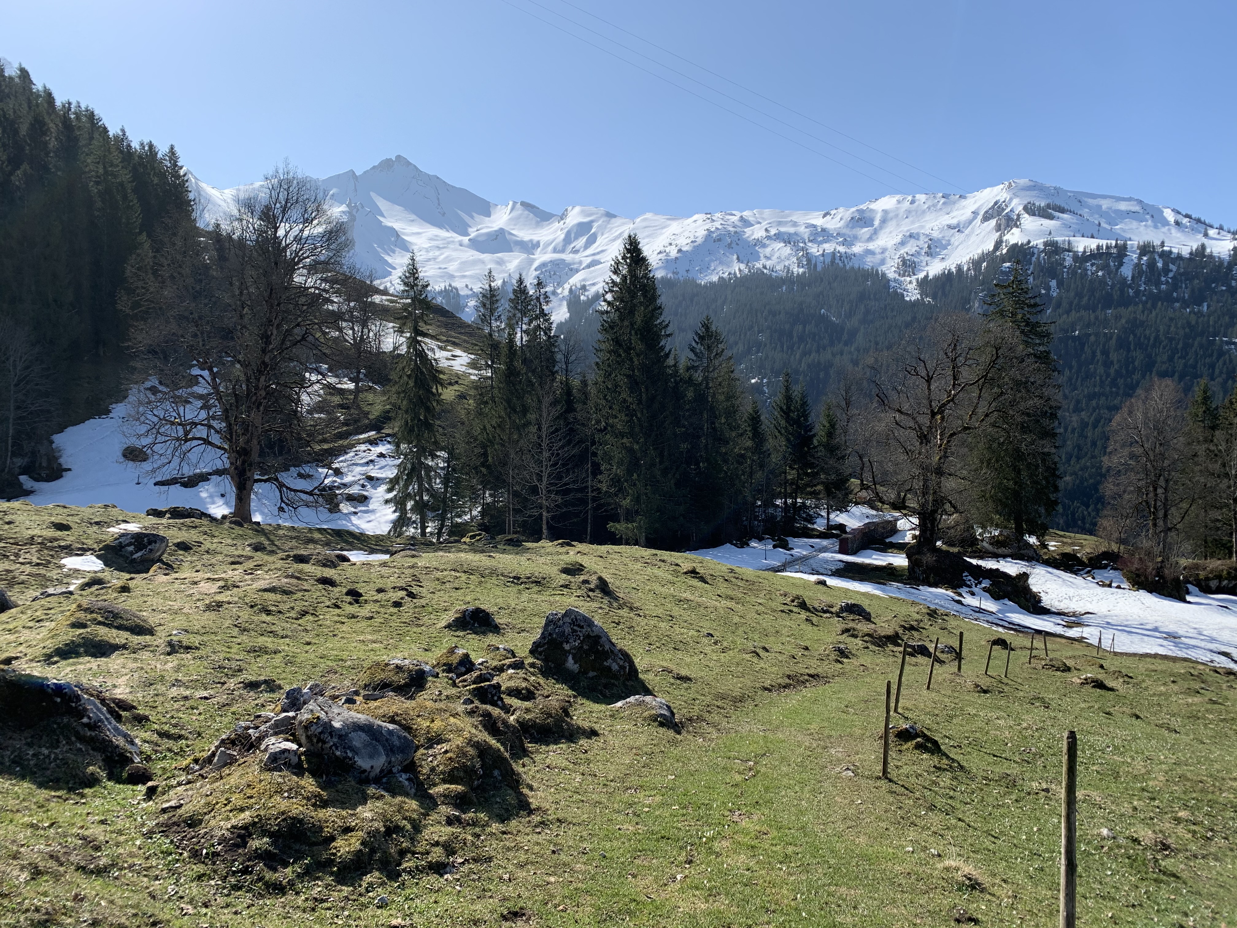
On my first trip to Nidwalden, I discovered a small hamlet called Niederrickenbach; a place full of very independent proud people and also a magical forest…
What Nidwalden has to offer: Niederrickenbach – A place of pilgrimage, mountain hiking with views, serene forests & grilling spots.
What Obwalden has to offer: Adventure amongst the rugged mountains of Engelberg
Maria-Rickenbach in Nidwalden
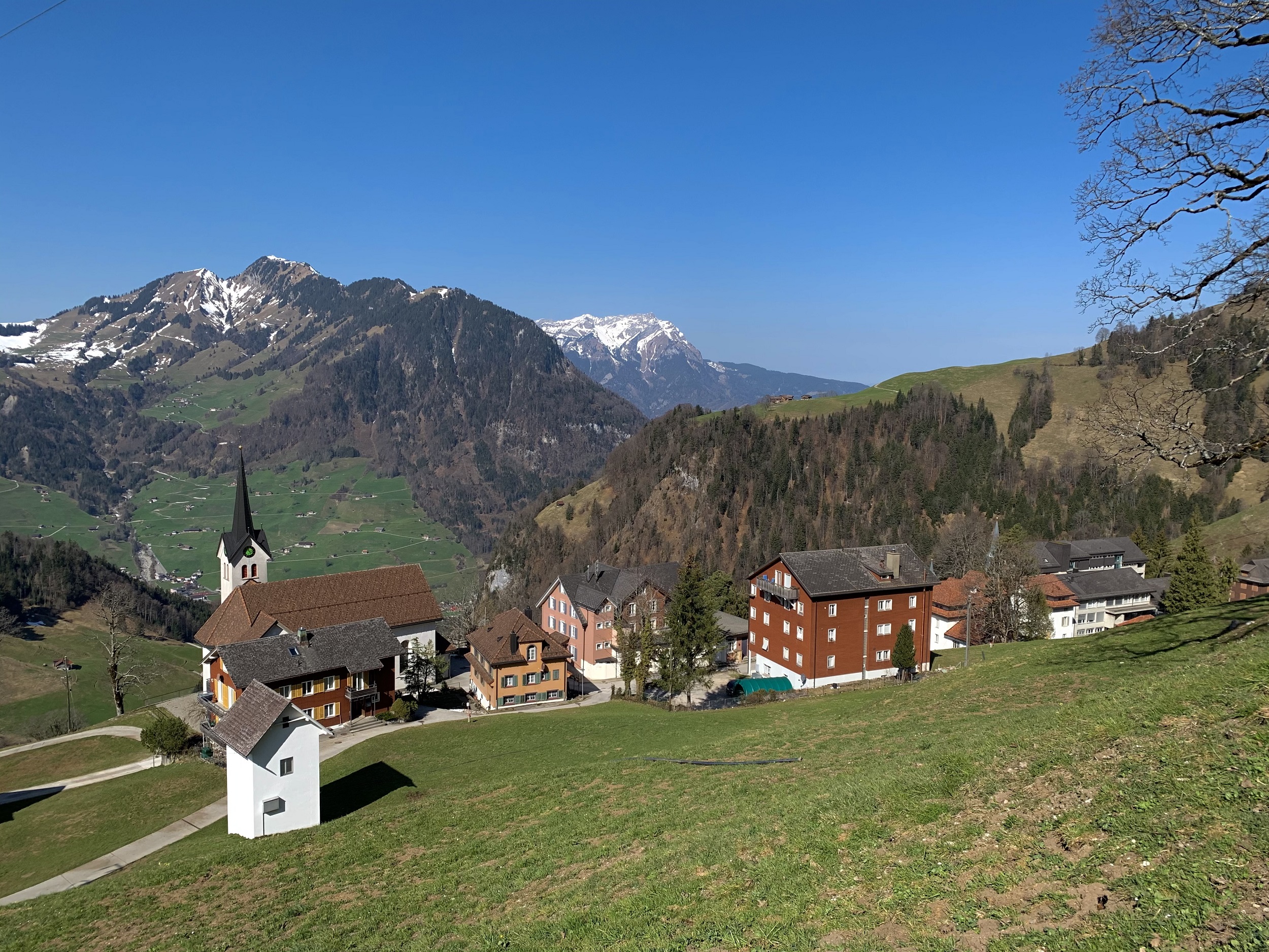
The Maria Rickenbach Dorf (village) sits on a sun terrace at around 1,165 metres. It can be reached on foot, by bicycle or by gondola but not by car.
This small, peaceful village is a wonderful natural environment; a place of pilgrimage and home to the impressive Convent of Maria-Rickenbach. It is surrounded by green meadows, alpine flowers, forests, rugged rocks and streams, in a mountainous environment. It is a serene place, undisturbed by cars.
Getting there
Train & Car: Lucerne Main Station to Dallenwil (lower Maria Rickenbach gondola Terminus) – 20 minutes. Train stop: Dallenwil. Car parks: at the terminus (no charges).
Gondolas: Maria Rickenbach: dep every 30 minutes from Dallenwil to Maria Rickenbach Village from 7:10am-6:40pm, every 30 minutes (extra departure at midday, and 7.10pm Fr/Sa). Musenalp: Only operates during the Alp time (Alpzeit) 15th May until 1st November. Departs when required.
Maria-Rickenbach Convent & Pilgrim House
The Benedictine Convent of Maria-Rickenbach is home to around 15 nuns and has a lovely shop that sells products made from its own herbs and home to a weaving mill.

A Place of Pilgrimage- Maria Rickenbach
The story of Maria Rickenbach begins in 1528. Tradition has it that a shepherd boy from Büren, saved a late Gothic Madonna statue during the Reformation in the Bernese Oberland and secretly carried it home. In the following spring he placed the statue in a hollow maple tree at the point where the altar of the Maria Rickenbach pilgrimage church now stands. When he wanted to lift the statue of the Madonna out of the tree hole on the alpine descent in autumn, it couldn’t be moved and so this is where it stayed.
The legend tells us that the Madonna had to stay here and could no longer be removed because it was here that she found peace and quiet in the seclusion of a beautiful mountain landscape. This place soon developed into a place of pilgrimage.
Activities in Maria-Rickenbach
By foot . . .
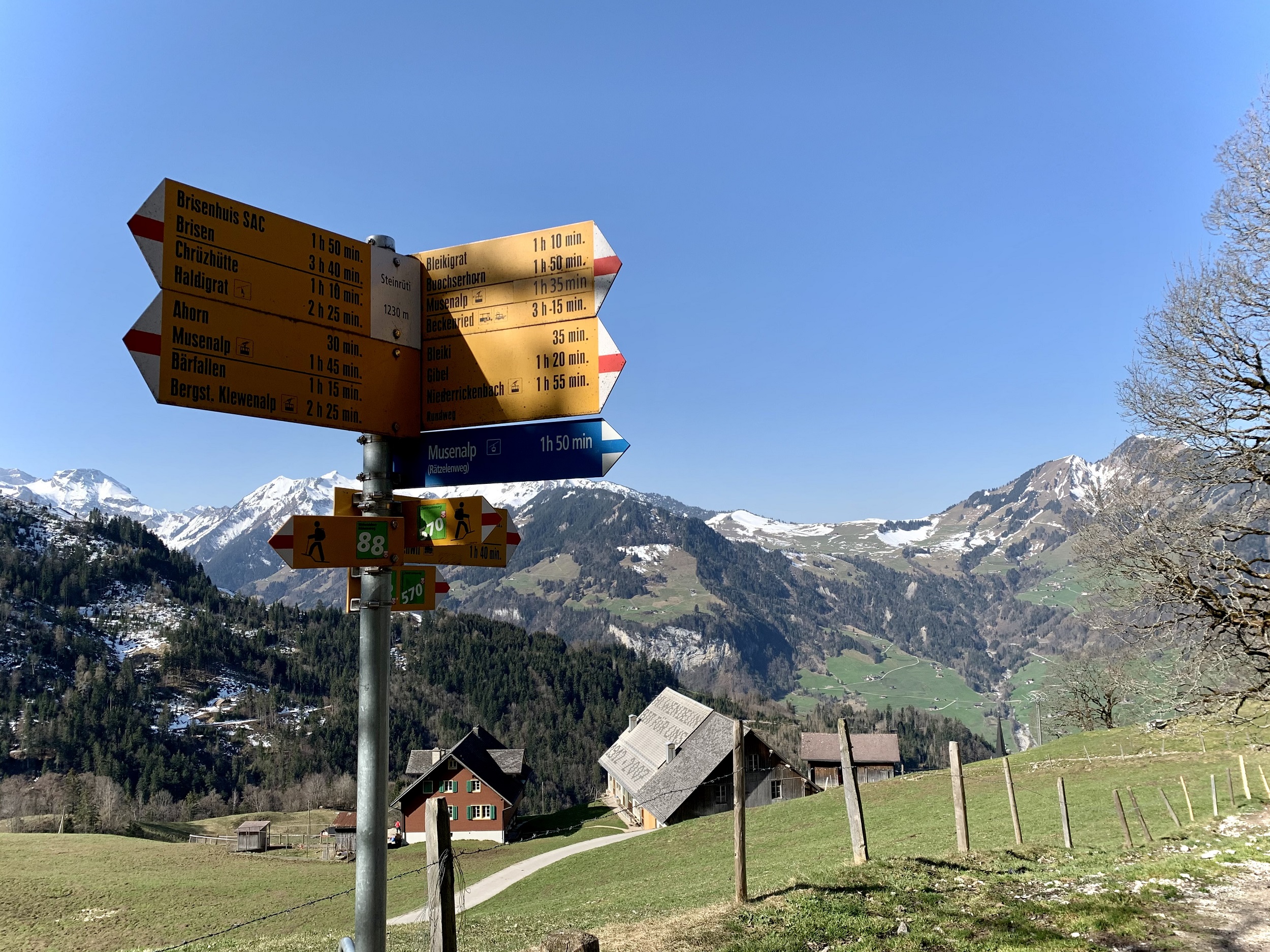
Maria-Rickenbach is also the setting-off point for many amazing hikes, including guided excursions such as the Alpine Herb Hike and, in winter, snowshoe hikes. Those aspiring to go higher can take the cable car to Musenalp. This is located directly next to the Maria-Rickenbach upper terminus. Another option is an approx. 30-minute easy walk from Maria-Rickenbach village to the Haldigrat chairlift (see below).
Once up the top of the gondolas & chairlifts, there are several hikes such as the walks to Brisen peak or along the Panorama trail up at Haldigrat (both will need a head for heights and sure-footedness with proper footwear).
FROM THE VALLEY STATION TO THE PILGRIM HOUSE
If you want to reach the pilgrims’ house on foot, you can take the beautiful hiking trail that starts right at the valley station. The path passes through forest, then, from about halfway, the walk continues on Alpstrasse towards Hasenmatt. The path now climbs over the flower meadows, past the Hasenmatt farm, to the pilgrims’ house.
From: Dallenwil Valley Station Distance: 4km, Elevation: 650m Duration: 2 hours
Haldigrat – Niederrickenbach/Dallenwil – top of Haldigrat chairlift

Photo 143681216 © Michal Stipek – Dreamstime.com
This walk includes the use of a small gondola ( Niederrickenbach/Dallenwil) & a chairlift (Haldigrat/Alpboden), as a starting point to various typical Nidwalden alpine hikes & tours.
When hunger calls

Barbecue spots: The region benefits from a large number of these outdoor grills as seen on the map (click to get a clearer view).
The Pilgerhaus Maria-Rickenbach is both a rustic restaurant & a Berggasthaus (Mountain Inn) with simple rooms.
Also worth a visit is the Musenalp Beizli & Alpkäserei (cheese dairy) – Serving simple food and drinks from the farm. Different types of alpine cheese and butter are produced in this small but modern dairy.
There is a walking trail from Niederrickenbach to the here, or take the Musenalp cable car in Niederrickenbach village. Open: Middle May – 1st November, Contact: www.musenalp-nw-ch.
Other Cheesie places . . .
Alpzeit (Alp time) at these Käserei is from May/June to September. This is when they are busy making cheese & open for business. At that time, there is the opportunity to purchase the cheese, sit down in the Beizli for a snack & drink or view the production including a Degustation. Often they only allow the viewing & sampling by appointment.
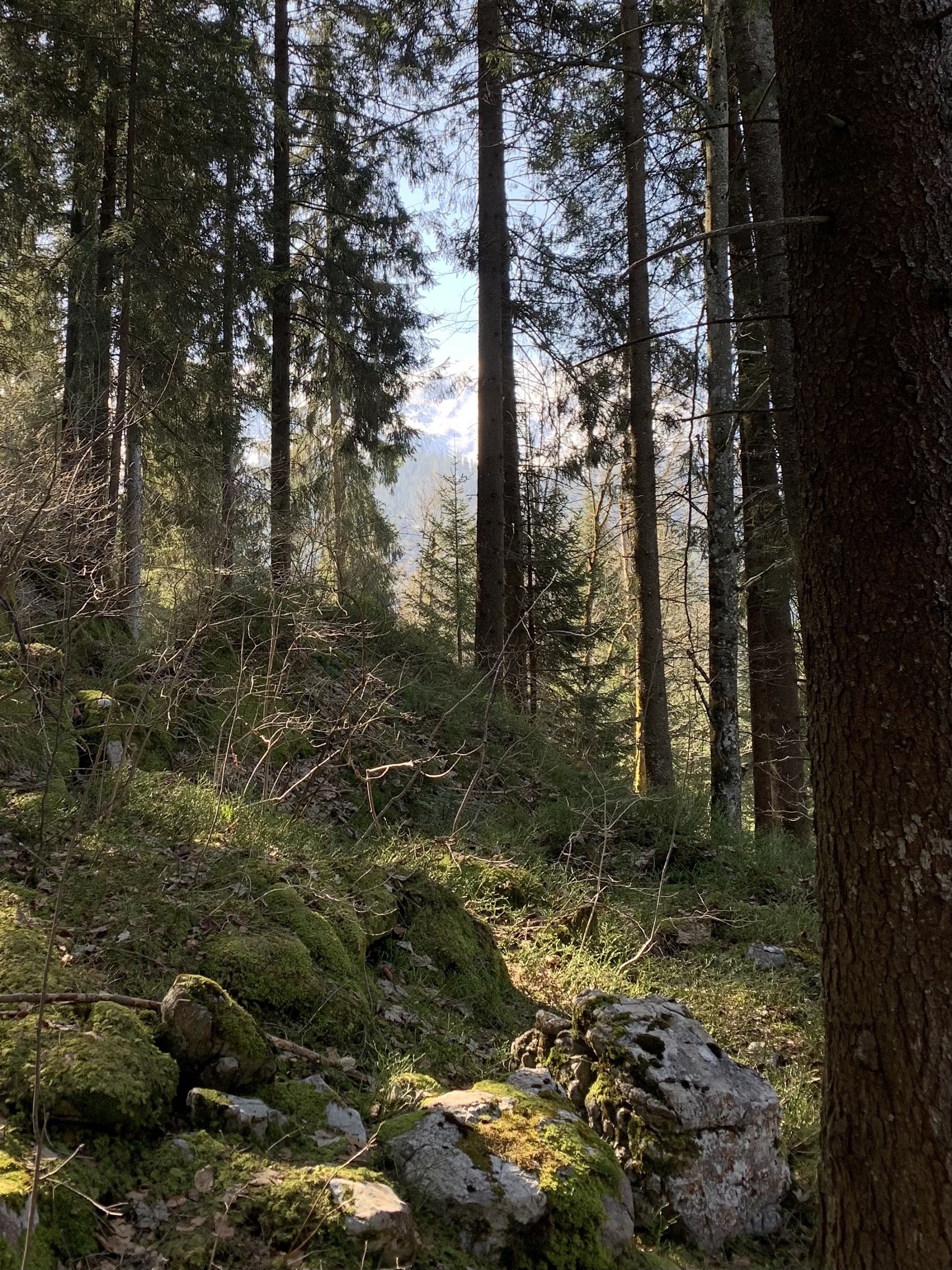
Alpkäserei Bleiki, 1400m – A 35 minute walk from Niederrickenbach village takes you to this Alpkäserei. (A gentle walk up 200m through the forest shown on my photos at the top of the page). Open from May to October. www.alpbleiki.ch ph. 079 546 77 60/041 620 51 50.
Alpkäserei Haghütte, 1510m – Alp Beizli with cheese and own meat specialties, good coffee and other sweet treats. Is situated at the top of the cable car from Oberrickenbach to Sinsgäuer Schonegg. Then partway along the walking trail between Oberrickenbach & Bannalp. Possible walking routes are «Bannalp – Sinsgäu – Oberrickenbach»;
«Sinsgäu – Gitschenen»; «Sinsgäu – Haldigrat (Zickzackweg)». Open through the summer. For more information ph 079 311 3263.
Obwalden – Engelberg, the Fürenalp Cable Car and the Via Ferratas
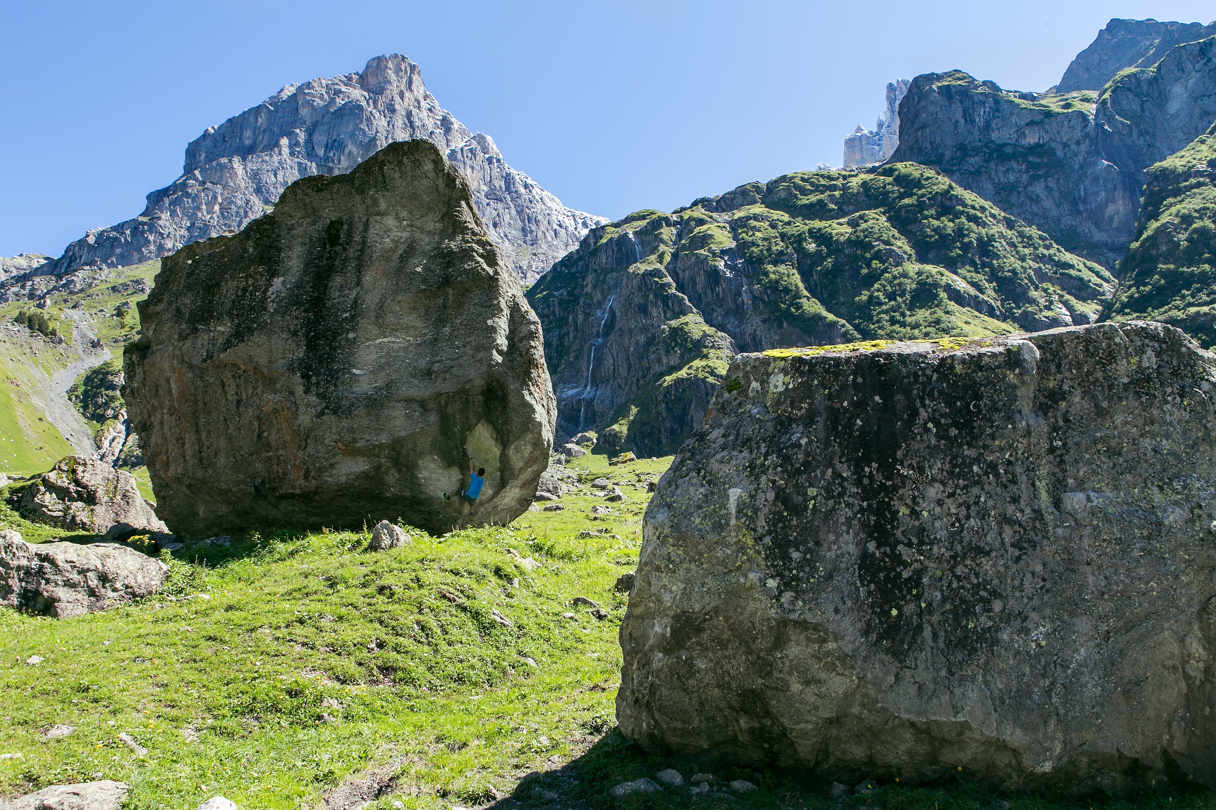
Cut off on three sides by mountains, Engelberg can only be approached by road and rail from the north. From here you can dive into the northern edge of the Alps – deep in the Engelberg valley. This valley is surrounded by high peaks and offers plenty of opportunities to spread out with tons of walking & hiking trails, cliffs to climb & places to grill. In Winter there is obviously plenty of skiing, winter walking and snowshoeing trails to try out.
Some of the specific experiences in this area are:
- Take the Fürenalp gondola, found near the end of the valley and then hiking back down.
- Trying a Via Ferrata climbing hike.
- Stopping at the mountain Inns & cheese dairies that sell fresh local produce.
For more details on each of these plus maps and links to other activities, see below:
Fürenalp – Stäuber Panorama Hike

Distance of hike: 9.2 km
Difficulty: moderate
Time of Year: May – September
Duration: approx. 3 hours
Ascent: 789 m (including cable car)
Descent: 783 m
Getting There
Train & Bus: Lucerne to Engelberg with the Engelberg – 43 mins; then Bus to Fürenalp – 12 mins; gondola every 15 mins (see gondola website for up-to-date info).
By Car: Lucerne to Fürenalp, Via A2 – 42 mins, 40 km; approx. 1 hour 15 mins from Basel, Zürich or Bern.
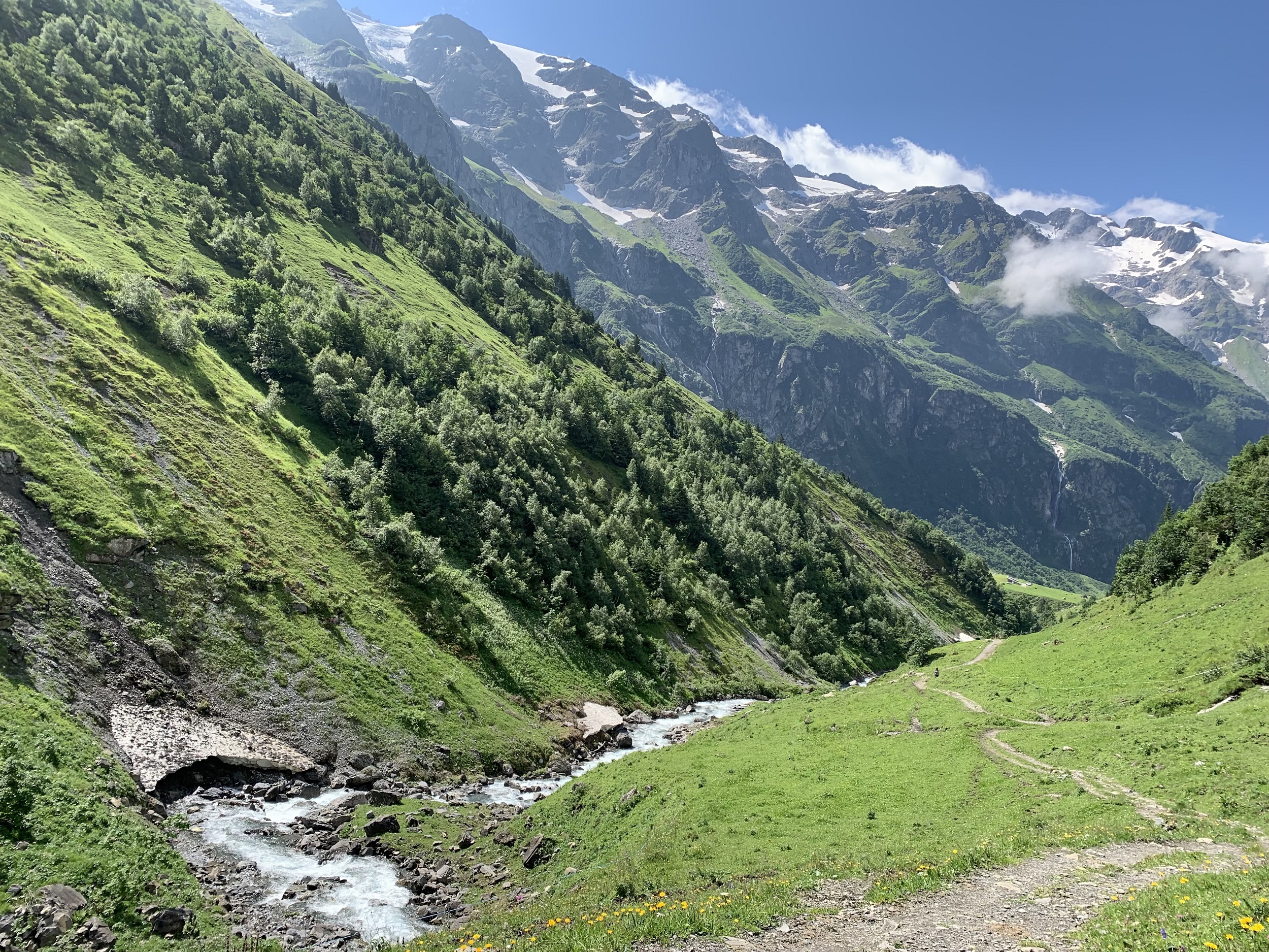
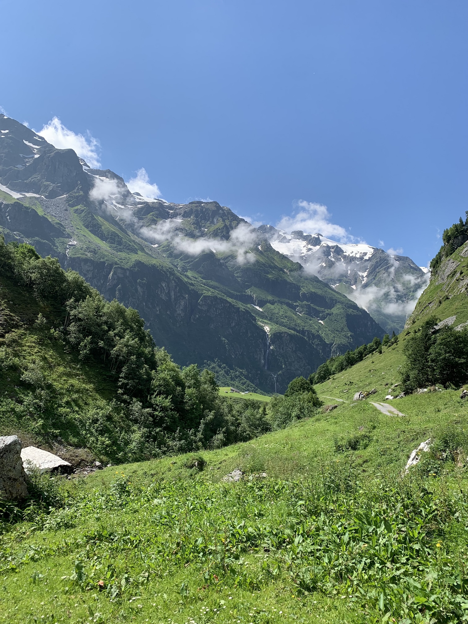
From the top of the Fürenalp gondola, about 6 km from the town, you will find yourself surrounded by rugged peaks and meadows with wildflowers. As soon as you reach the top station the vistas are outstanding. From here it is easy to take off in various directions to immerse yourself in this amazing place.
This lovely downhill trail is called the Stäuber panorama hike(see my map below). It starts at the top of Fürenalp gondola, gradually descending down through the meadows to the Stäuber waterfall, then along the Engelberger Aa river valley, back to the Fürenalp car park with an alternative shorter version using the smaller Äbnet gondola.
For further Fürenalp hiking ideas with maps go here.
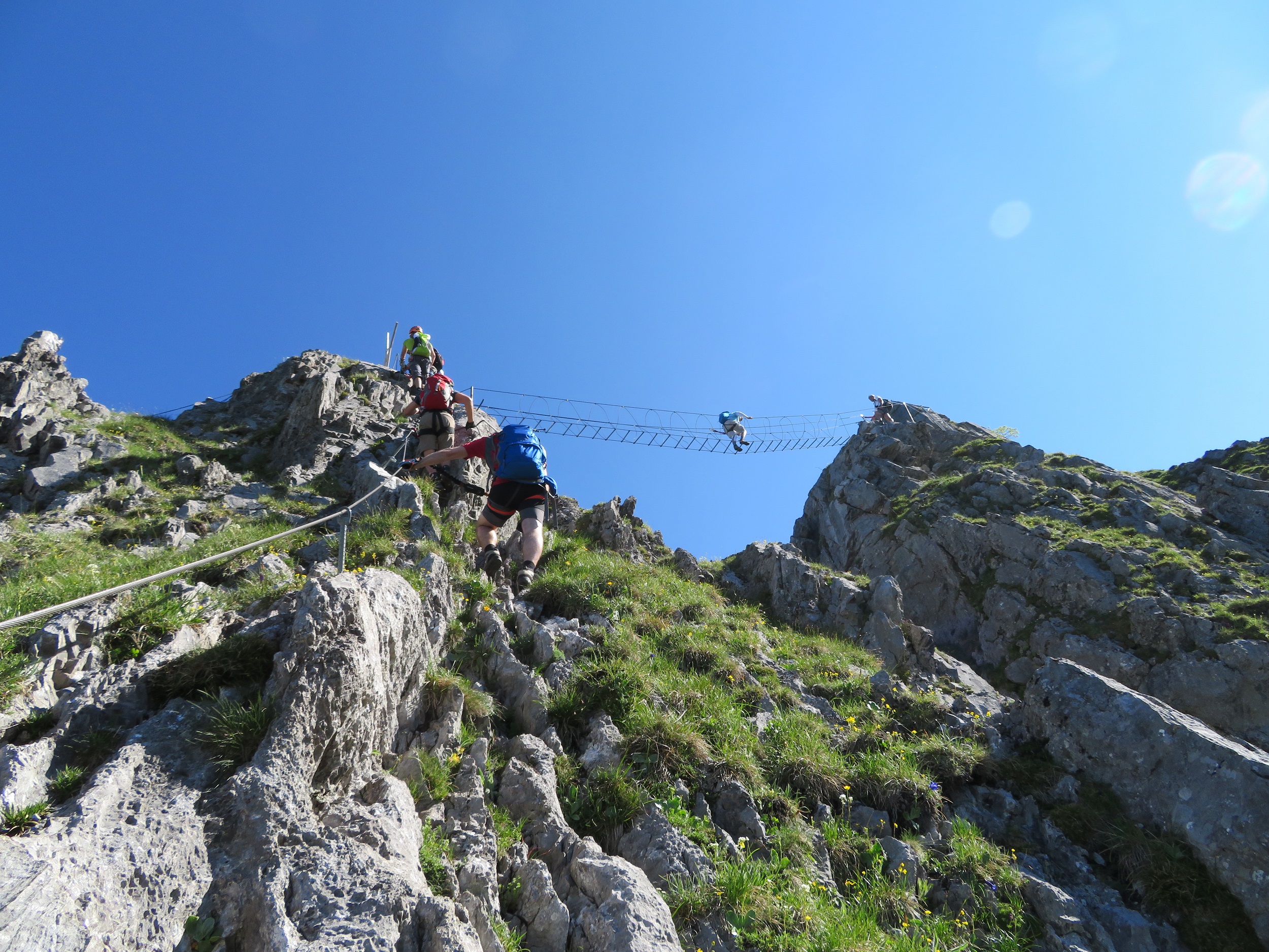
Via Ferrata
For thrill-seekers, there are Klettergärten (rock climbing areas), a rope park and, to experience some serious rock climbing, the Via Ferrata climb which offers a much more challenging way of reaching the Fürenalp mountain restaurant.
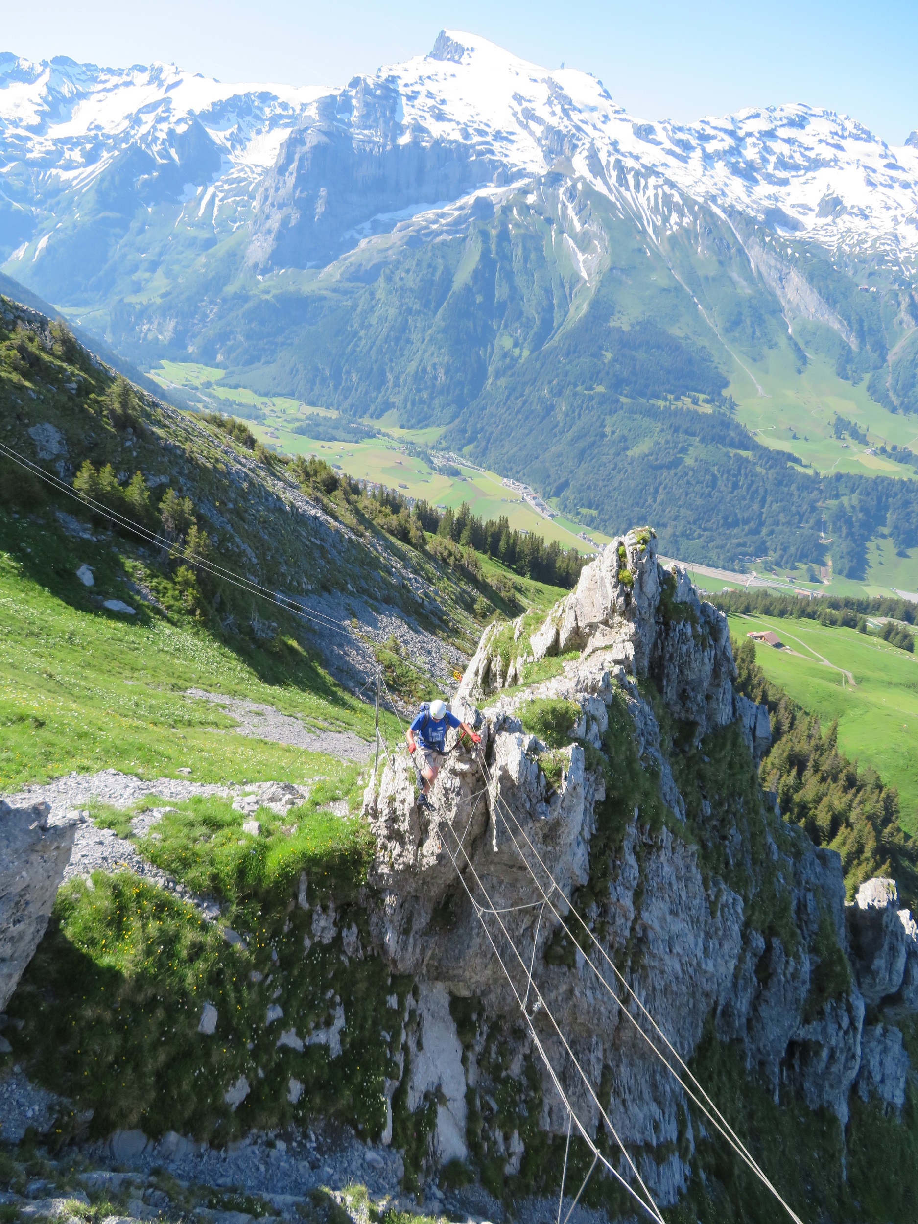
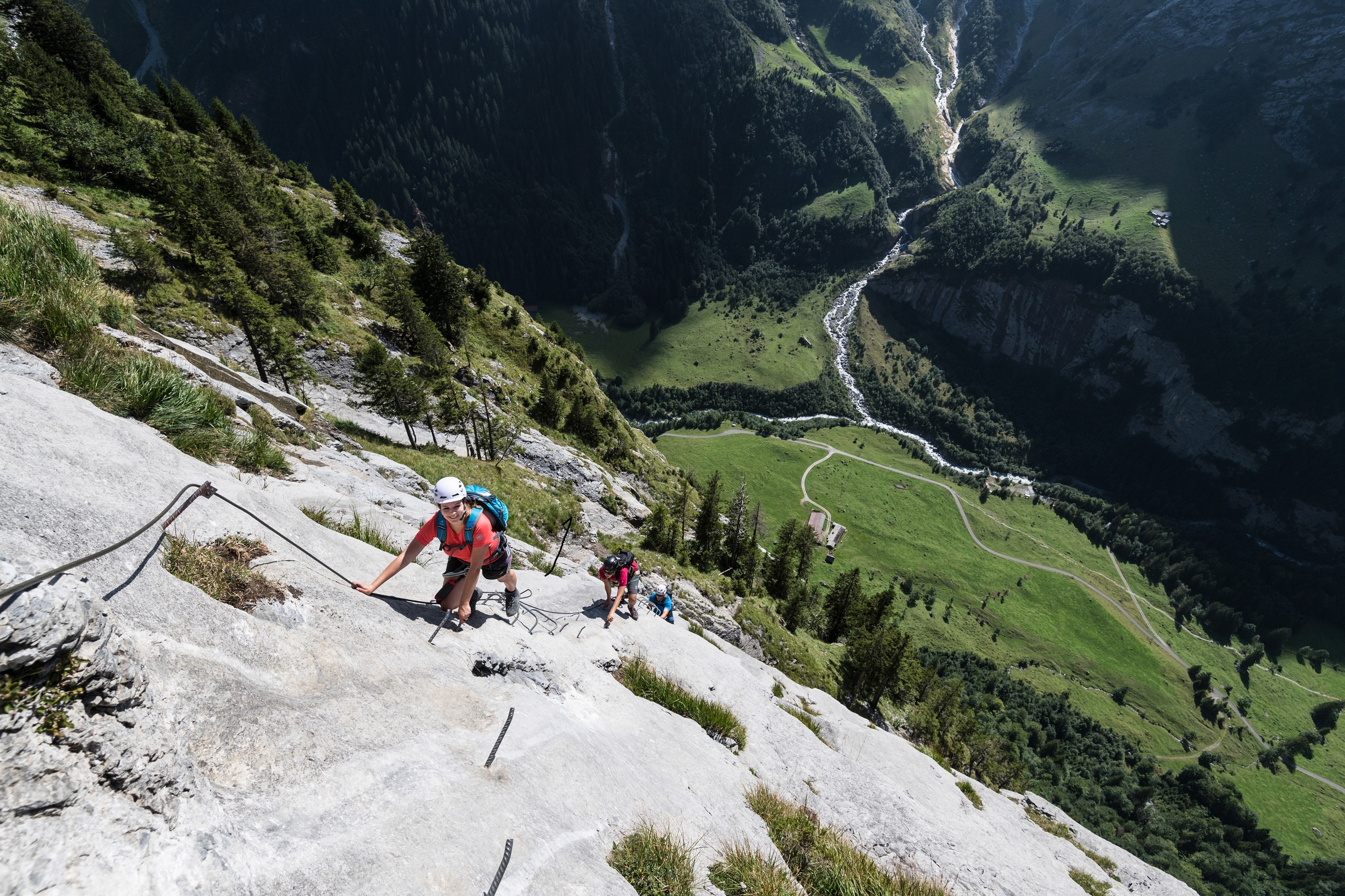
Cables, iron pegs and ladders are the tools used for the Via Ferrata. There are 6 options around Engelberg. These offer a challenging way of climbing the 5 peaks – Rigidalstock 2,593m, Fürenalp 1,845m, Graustock 2,662m & Tällistock 2,580m (canton Bern). Engelberg-Titlis Tourism is happy to help and have detailed booklets with maps and contact details for guides and equipment rentals.
The climbs have varying levels of difficulty – from beginner to advanced. Two important points to note:
- Engelberg-Titlis Tourism highly recommends inexperienced climbers to use an experienced guide.
- Alpine Equipment is essential. This includes helmets, sturdy boots, safety straps and karabiner and gloves are recommended. You can rent the equipment from sport shops all over Engelberg.
Alp Käserei and Beizli – (alpine cheese dairies and small restaurants)
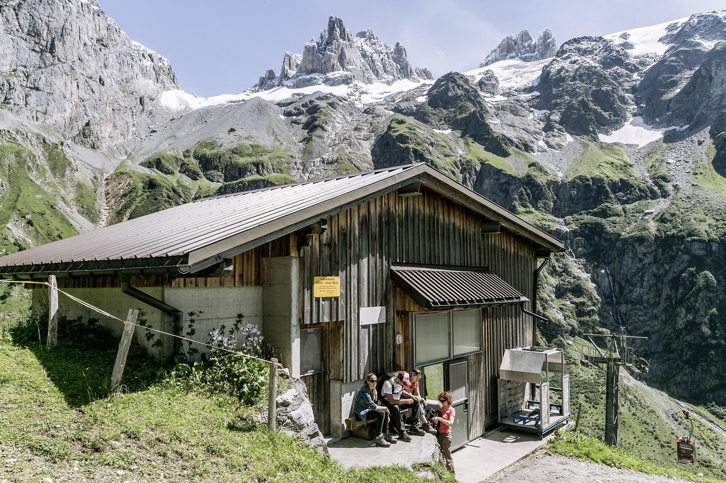
Several of these are dotted throughout the area with signposts pointing the way. The dairy products come straight from the cows seen in the surrounding meadows. The Alpkäserei & Berggasthaus Stäfeli tucked away in the valley, below the Fürenalp gondola is a good example.
It is always important to respect the natural environment and farming areas by sticking to the trails. The farmers that graze their stock around the meadows in this area work hard to ensure the natural environment is protected, therefore, any visitors to the area need to do the same thing.
Panorama Map showing Fürenalp Cable Car and the Fürenwand; the king of Engelberg’s Via Ferratas.

*The information from my introduction comes from an article written in the Luzerner Zeitung, December 29, 2018. Their source was Carl Bossard who did a lecture on the relationship between the two cantons, together with Engelberg songwriter El Ritschi, in May 2018 – both call these half-cantons home.
Bottom right photo in media gallery at top of page by: File ID 160078955 | © Mario Krpan | Dreamstime.com. “Grassy wooded alpine peak Musenalp”